Sunday, May 30, 2010

All Stop


Kathleen and I went to Chinatown this afternoon for lunch - and to make a pilgrimage to 7th & H, where DC has recently installed the first all-way cross in this area. I have heard of these in places like Barcelona, and I know there are some in the Virginia Beach area, but I have never seen one first-hand.
After watching how things go for a while, we took our first walk through the middle of the intersection. Most people seemed to prefer crossing at the traditional place, but it was nice to see all crosswalks in use simultaneously! I hope this experiment pays off and that this practice of putting pedestrians first in certain areas grows.


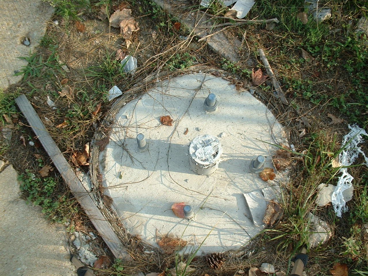
On the way there and back we ran into a number of obstructions - all in usual places. First of all, SHA is still working on the ramps and APS at Wayne and Georgia. It has been more that a week sinces this particular corner - the SE corner - has been obstructed. We stood there and watched for a while as people walked around this area by stepping into Georgia Avenue, as we did ourselves. Hundreds will do this same thing come Tuesday morning.

And, finally, here we are in front of the old Silver Spring Volunteer Fire Station once again - blocked by a parked vehicle. Parked right-up to the edge.


Tanks for sending this. I had heard about it, but hadn't seen it. Cause to celebrate! kINDA MADE ME FEEL LIKE DANCING TOO.

Wednesday, May 26, 2010

Interactive Map


View Montgomery Sideways in a larger map
This map shows a couple of places I have recorded as pedestrian problem locations. The map is open for anyone to use. See if you can post a location on here, and let me know how it goes.

More Fun with Google


I was asked to help find some of the locations where utility poles create obstructions - with an emphasis on those that may have been replaced in recent years. I used Google Street Views to find these examples. There are many, many more. You can see the old poles still in place in a few images, and new concrete at the base of some of the poles. Badly-placed poles seem to run in strings.

http://maps.google.com/maps?hl=en&ie=UTF8&t=h&layer=c&cbll=38.998857,-77.024067&panoid=zrbUxN0Xf4QGz4tL082vqA&cbp=12,29.37,,2,10.15&ll=38.998801,-77.023973&spn=0,0.001313&z=20


http://maps.google.com/maps?hl=en&ie=UTF8&t=h&layer=c&cbll=39.023289,-77.016918&panoid=kUyDSZXrw8Sgi-0ta5RI7Q&cbp=12,8.17,,0,-7.26&ll=39.023221,-77.016848&spn=0,0.001313&z=20

http://maps.google.com/maps?hl=en&ie=UTF8&t=h&layer=c&cbll=39.023575,-77.017213&panoid=SmmrV00t4gqc76Ed5SauWg&cbp=12,89.5,,0,9.51&ll=39.023575,-77.017213&spn=0,0.001313&z=20

http://maps.google.com/maps?hl=en&ie=UTF8&t=h&layer=c&cbll=39.024063,-77.017786&panoid=igZa2TsrH4u5NBFjIIbYkw&cbp=12,99.47,,0,8.19&ll=39.023998,-77.017707&spn=0,0.001313&z=20

http://maps.google.com/maps?hl=en&ie=UTF8&t=h&layer=c&cbll=39.024699,-77.018876&panoid=fUrnndWalgGES4NU_rw1Aw&cbp=12,69.86,,0,11.17&ll=39.024699,-77.018876&spn=0,0.002626&z=19

http://maps.google.com/maps?hl=en&ie=UTF8&t=h&layer=c&cbll=38.995291,-77.022102&panoid=F_lGSO0YyasFyPsVicatzg&cbp=12,263.06,,0,24.37&ll=38.995193,-77.022104&spn=0,0.001313&z=20


http://maps.google.com/maps?hl=en&ie=UTF8&t=h&layer=c&cbll=38.997432,-77.021506&panoid=gQ89RTcnGGTOeQSH59sWtg&cbp=12,119.38,,0,10.98&ll=38.997342,-77.021623&spn=0,0.001313&z=20

http://maps.google.com/maps?hl=en&ie=UTF8&t=h&layer=c&cbll=38.9976,-77.021286&panoid=czJ39mMarSrbuh1gLsmz2Q&cbp=12,103.11,,0,12.63&ll=38.997505,-77.021413&spn=0,0.001313&z=20

http://maps.google.com/maps?hl=en&ie=UTF8&t=h&layer=c&cbll=38.997841,-77.020974&panoid=4BkNNT-W__F_hblKYJ3IHg&cbp=12,125.26,,0,19.34&ll=38.997779,-77.021051&spn=0,0.001313&z=20

http://maps.google.com/maps?hl=en&ie=UTF8&t=h&layer=c&cbll=38.997931,-77.020887&panoid=0-CHkvr8SSrh0YhEoIDfCQ&cbp=12,78.64,,0,3.9&ll=38.998061,-77.020764&spn=0,0.001313&z=20

http://maps.google.com/maps?hl=en&ie=UTF8&t=h&layer=c&cbll=38.998369,-77.02054&panoid=dZ2xVVnvb6j9xVg8GB8q5A&cbp=12,148.49,,2,13.27&ll=38.998288,-77.020597&spn=0,0.001313&z=20

http://maps.google.com/maps?hl=en&ie=UTF8&t=h&layer=c&cbll=38.998554,-77.020406&panoid=g-omkiblCL2rywDVnd_PIg&cbp=12,153.08,,2,14.56&ll=38.99847,-77.020466&spn=0,0.001313&z=20


http://maps.google.com/maps?hl=en&ie=UTF8&t=h&layer=c&cbll=38.99871,-77.020197&panoid=8tYJ4tLtea8vDf-KUg69sQ&cbp=12,89.2,,2,6.82&ll=38.99871,-77.020197&spn=0,0.001313&z=20

http://maps.google.com/maps?hl=en&ie=UTF8&t=h&layer=c&cbll=38.998894,-77.019744&panoid=rn2UY7jaHixALkViSJLZHw&cbp=12,45.54,,2,11.69&ll=38.998849,-77.019856&spn=0,0.001313&z=20

http://maps.google.com/maps?hl=en&ie=UTF8&t=h&layer=c&cbll=38.998794,-77.019989&panoid=0B2q65pgsagzeXpZG_e_LQ&cbp=12,306.31,,0,14.87&ll=38.998794,-77.019989&spn=0,0.001313&z=20

http://maps.google.com/maps?hl=en&ie=UTF8&t=h&layer=c&cbll=38.998554,-77.020406&panoid=g-omkiblCL2rywDVnd_PIg&cbp=12,297.74,,0,22.03&ll=38.99862,-77.020323&spn=0,0.001313&z=20


http://maps.google.com/maps?hl=en&ie=UTF8&t=h&layer=c&cbll=38.997375,-77.022064&panoid=5n6FyNuEkWqHMSw2rX46-g&cbp=12,49.61,,0,16.32&ll=38.997314,-77.02199&spn=0,0.001313&z=20

http://maps.google.com/maps?hl=en&ie=UTF8&t=h&layer=c&cbll=38.997618,-77.022365&panoid=2fVDi48OFPX_IqTxZ0ttWg&cbp=12,104.82,,2,8.08&ll=38.997535,-77.022262&spn=0,0.001313&z=20

http://maps.google.com/maps?hl=en&ie=UTF8&t=h&layer=c&cbll=38.997708,-77.022477&panoid=eDnPuiusRk1YCsDvJlMzdg&cbp=12,9.83,,2,11.46&ll=38.99779,-77.02258&spn=0,0.001313&z=20


http://maps.google.com/maps?hl=en&ie=UTF8&t=h&layer=c&cbll=38.99788,-77.022689&panoid=N_9PNytTGn7riat3mS_ekQ&cbp=12,58.03,,2,16.97&ll=38.997802,-77.022593&spn=0,0.001313&z=20

http://maps.google.com/maps?hl=en&ie=UTF8&t=h&layer=c&cbll=38.998115,-77.02298&panoid=9X1ScZfP0cGeVltJPi6OWw&cbp=12,138.01,,0,15.66&ll=38.998031,-77.022877&spn=0,0.001313&z=20

http://maps.google.com/maps?hl=en&ie=UTF8&t=h&layer=c&cbll=38.998353,-77.023325&panoid=OnIx8_sXRRte13fWFDfy1A&cbp=12,47.62,,2,11.31&ll=38.998284,-77.023226&spn=0,0.001313&z=20

http://maps.google.com/maps?hl=en&ie=UTF8&t=h&layer=c&cbll=38.998439,-77.023448&panoid=PY6V-RjuZKH8wFgoBl4dlQ&cbp=12,61.14,,2,14.08&ll=38.998358,-77.023333&spn=0,0.001313&z=20

http://maps.google.com/maps?hl=en&ie=UTF8&t=h&layer=c&cbll=38.998503,-77.023542&panoid=6tcHsBut-eQ1g266eI_Y7Q&cbp=12,2.06,,2,9.62&ll=38.998445,-77.023458&spn=0,0.001313&z=20


http://maps.google.com/maps?hl=en&ie=UTF8&t=h&layer=c&cbll=38.998733,-77.023874&panoid=2aQ1HTZH8cCfHUZOcxeBpw&cbp=12,75.71,,2,12.22&ll=38.998654,-77.02376&spn=0,0.001313&z=20

http://maps.google.com/maps?hl=en&ie=UTF8&t=h&layer=c&cbll=39.000105,-77.02892&panoid=z_Tv1j_LcnrXXLcvomJblw&cbp=12,180.77,,0,11.77&ll=39.000105,-77.02892&spn=0,0.001313&z=20

http://maps.google.com/maps?hl=en&ie=UTF8&t=h&layer=c&cbll=39.000003,-77.028676&panoid=I958uNjp3u0R54BMLF5SUA&cbp=12,195.4,,0,13.97&ll=39.000056,-77.028804&spn=0,0.001313&z=20


http://maps.google.com/maps?hl=en&ie=UTF8&t=h&layer=c&cbll=38.999784,-77.028146&panoid=sZ9-QNi9c-3X0zjUMZE2iQ&cbp=12,355.54,,1,21.05&ll=38.999829,-77.028254&spn=0,0.001313&z=20

Tuesday, May 25, 2010

Fun With Google Street Views

http://maps.google.com/maps?hl=en&ie=UTF8&t=h&ll=38.991469,-77.026482&spn=0,0.001313&z=20&layer=c&cbll=38.991412,-77.026547&panoid=DRFh63RZz2QUgwlMO-iIjg&cbp=12,91.57,,0,14.74

http://maps.google.com/maps?hl=en&ie=UTF8&t=h&layer=c&cbll=38.990251,-77.026002&panoid=nevQRRbPGrbPWoj41MuOOQ&cbp=12,14.59,,0,16.97&ll=38.990239,-77.025947&spn=0,0.001313&z=20

http://maps.google.com/maps?hl=en&ie=UTF8&t=h&layer=c&cbll=38.990237,-77.025425&panoid=38FYOz9a1aFZITz6nVIB-A&cbp=12,148.56,,0,33.3&ll=38.990234,-77.025305&spn=0,0.001313&z=20

http://maps.google.com/maps?hl=en&ie=UTF8&t=h&layer=c&cbll=38.990226,-77.025013&panoid=OIYShpiX1QLHoBLTUvKKgg&cbp=12,153.16,,0,24.57&ll=38.990222,-77.024889&spn=0,0.001313&z=20

http://maps.google.com/maps?hl=en&ie=UTF8&t=h&layer=c&cbll=38.990214,-77.024555&panoid=jbjc-Wq6rIubNem0I2Hkcg&cbp=12,153.62,,0,25.85&ll=38.990218,-77.024707&spn=0,0.001313&z=20

http://maps.google.com/maps?hl=en&ie=UTF8&t=h&layer=c&cbll=38.991419,-77.010826&panoid=hmS6fjIO-xlqf7Yajwf_4w&cbp=12,65.82,,0,13.18&ll=38.991428,-77.01072&spn=0,0.001313&z=20

http://maps.google.com/maps?hl=en&ie=UTF8&t=h&layer=c&cbll=38.997704,-77.02115&panoid=er-xjS__E5qYTB8JMM7PFA&cbp=12,169.81,,0,16.84&ll=38.997605,-77.021279&spn=0,0.001313&z=20
http://maps.google.com/maps?hl=en&ie=UTF8&t=h&layer=c&cbll=38.997499,-77.021419&panoid=ohhkzRXr8aHwmqSFhK65hA&cbp=12,180.93,,0,16.74&ll=38.997594,-77.021292&spn=0,0.001313&z=20

http://maps.google.com/maps?hl=en&ie=UTF8&t=h&layer=c&cbll=38.996868,-77.022241&panoid=_S-b8bTaMR9VvGHAqrt3AQ&cbp=12,164.51,,0,15.03&ll=38.996951,-77.022134&spn=0,0.001313&z=20

http://maps.google.com/maps?hl=en&ie=UTF8&t=h&layer=c&cbll=38.99661,-77.022577&panoid=tXJgvtN-5aKJIPiuTET8Sg&cbp=12,119.83,,0,16.14&ll=38.996691,-77.022474&spn=0,0.001313&z=20

http://maps.google.com/maps?hl=en&ie=UTF8&t=h&layer=c&cbll=38.99635,-77.022915&panoid=J7VFJ3H5Ov5iMlUz5nYoaQ&cbp=12,87.42,,0,11.03&ll=38.996431,-77.022809&spn=0,0.001313&z=20


http://maps.google.com/maps?hl=en&ie=UTF8&t=h&layer=c&cbll=38.996196,-77.023128&panoid=3dQEu4ui8MgDDAfrkfiuNQ&cbp=12,109.79,,0,9.84&ll=38.996252,-77.02305&spn=0,0.001313&z=20

http://maps.google.com/maps?hl=en&ie=UTF8&t=h&layer=c&cbll=38.995839,-77.023652&panoid=oJCpnQjkXKLrDz5bLfR6-g&cbp=12,118.63,,0,10.37&ll=38.995918,-77.02353&spn=0,0.002626&z=19

http://maps.google.com/maps?hl=en&ie=UTF8&t=h&layer=c&cbll=38.995689,-77.023908&panoid=U8E3mlC8C_aR3yc1AzRpaw&cbp=12,116.47,,0,8.55&ll=38.995754,-77.023791&spn=0,0.002626&z=19

http://maps.google.com/maps?hl=en&ie=UTF8&t=h&layer=c&cbll=38.995505,-77.02424&panoid=evvZVQdcXxpeX0ZyquZU1Q&cbp=12,107.1,,0,11.47&ll=38.995568,-77.024129&spn=0,0.001313&z=20


http://maps.google.com/maps?hl=en&ie=UTF8&t=h&layer=c&cbll=38.998461,-77.020473&panoid=oVZpgyqmmFtsGdvGYR5ZYA&cbp=12,350.34,,0,14.18&ll=38.998377,-77.020533&spn=0,0.001313&z=20

http://maps.google.com/maps?hl=en&ie=UTF8&t=h&layer=c&cbll=38.998794,-77.019989&panoid=0B2q65pgsagzeXpZG_e_LQ&cbp=12,313.85,,0,11.53&ll=38.998794,-77.019989&spn=0,0.001313&z=20


http://maps.google.com/maps?hl=en&ie=UTF8&t=h&layer=c&cbll=38.998894,-77.019744&panoid=rn2UY7jaHixALkViSJLZHw&cbp=12,47.81,,0,11.92&ll=38.998894,-77.019744&spn=0,0.001313&z=20

http://maps.google.com/maps?hl=en&ie=UTF8&t=h&layer=c&cbll=38.999572,-77.025888&panoid=L2WUHZ_ETbtZVcfXP8s-SA&cbp=12,288.38,,0,9.63&ll=38.999572,-77.025888&spn=0,0.001313&z=20

http://maps.google.com/maps?hl=en&ie=UTF8&t=h&layer=c&cbll=39.000087,-77.025713&panoid=eV2CIaizkgS3is1LVG1GHA&cbp=12,130.67,,0,9.6&ll=39.000195,-77.025671&spn=0,0.001313&z=20

http://maps.google.com/maps?hl=en&ie=UTF8&t=h&layer=c&cbll=38.999685,-77.025844&panoid=iKSTNscuR-dfA9MX21R3FQ&cbp=12,131.77,,0,8.32&ll=38.999796,-77.025808&spn=0,0.001313&z=20

http://maps.google.com/maps?hl=en&ie=UTF8&t=h&layer=c&cbll=39.001583,-77.025054&panoid=oalkZRnN4TlSoJdsfwYDIA&cbp=12,69.9,,0,-7.38&ll=39.001583,-77.025054&spn=0,0.001313&z=20

http://maps.google.com/maps?hl=en&ie=UTF8&t=h&layer=c&cbll=39.002588,-77.024546&panoid=SZsAblwLsIcrnl35ER7UUg&cbp=12,312.83,,0,-4.67&ll=39.002729,-77.024458&spn=0,0.001313&z=20

http://maps.google.com/maps?hl=en&ie=UTF8&t=h&layer=c&cbll=39.002289,-77.024701&panoid=DLM7P4ecplT_WzA8EV5TUA&cbp=12,331.93,,2,7.81&ll=39.002289,-77.024701&spn=0,0.001313&z=20

http://maps.google.com/maps?hl=en&ie=UTF8&t=h&layer=c&cbll=39.004049,-77.023721&panoid=mEABZ0J5AMtbseUwevGjww&cbp=12,304.15,,2,12.04&ll=39.004049,-77.023721&spn=0,0.001313&z=20


http://maps.google.com/maps?hl=en&ie=UTF8&t=h&layer=c&cbll=39.004049,-77.023721&panoid=mEABZ0J5AMtbseUwevGjww&cbp=12,103.16,,1,7.32&ll=39.004049,-77.023721&spn=0,0.001313&z=20

http://maps.google.com/maps?hl=en&ie=UTF8&t=h&layer=c&cbll=39.005236,-77.02287&panoid=L2VzxeUiabGUDksyaJMz0A&cbp=12,328.08,,0,8.93&ll=39.00514,-77.02295&spn=0,0.001313&z=20

http://maps.google.com/maps?hl=en&ie=UTF8&t=h&layer=c&cbll=39.00566,-77.022504&panoid=mUpzngPN1cUzuJI9h_yiuQ&cbp=12,118.66,,0,9.72&ll=39.005542,-77.022617&spn=0,0.001313&z=20


http://maps.google.com/maps?hl=en&ie=UTF8&t=h&layer=c&cbll=39.005913,-77.022261&panoid=WIb3EKpeFfpE64maF1UJ-Q&cbp=12,133.71,,0,16.31&ll=39.005791,-77.022378&spn=0,0.001313&z=20


http://maps.google.com/maps?hl=en&ie=UTF8&t=h&layer=c&cbll=39.006353,-77.02183&panoid=wxuM4Xjo_k9FQbYoqPEfgA&cbp=12,305.33,,0,10.64&ll=39.006228,-77.021957&spn=0,0.001313&z=20

http://maps.google.com/maps?hl=en&ie=UTF8&t=h&layer=c&cbll=39.010842,-77.017457&panoid=XfBA3rLzRDywkY6wVCP3BA&cbp=12,226.41,,0,9.57&ll=39.010709,-77.017508&spn=0,0.001313&z=20


http://maps.google.com/maps?hl=en&ie=UTF8&t=h&layer=c&cbll=39.011536,-77.017196&panoid=1fIqE8R2WhhDi7DAMD1rUw&cbp=12,231.21,,0,8.4&ll=39.011406,-77.017245&spn=0,0.001313&z=20


http://maps.google.com/maps?hl=en&ie=UTF8&t=h&layer=c&cbll=39.011951,-77.017045&panoid=LuhD7N1q3IDmWk-D8PvXhA&cbp=12,19.81,,0,11.2&ll=39.012082,-77.017001&spn=0,0.001313&z=20

http://maps.google.com/maps?hl=en&ie=UTF8&t=h&layer=c&cbll=39.012371,-77.016905&panoid=e8rO6dM0gurEq1hKk7iCDA&cbp=12,1.91,,0,9.99&ll=39.012237,-77.01695&spn=0,0.001313&z=20


http://maps.google.com/maps?hl=en&ie=UTF8&t=h&layer=c&cbll=39.014166,-77.016811&panoid=d9sJPgN7jWeFCeHBuZmA7g&cbp=12,322.05,,1,6.99&ll=39.014166,-77.016811&spn=0,0.001313&z=20

Monday, May 24, 2010

Georgia on My Mind


The Georgia Avenue Corridor is one of the most dangerous places for pedestrians in Montgomery County, and Maryland. SHA and MCDPS should be ashamed! Here are more examples of how poor planning and neglect get people hurt and killed!

This afternoon Will and I set out for the Silver Spring Metro Station and Wheaton Plaza. We walked down Georgia Avenue, along the east side from Sligo to Wayne. Once again, in front of the former Silver Spring Volunteer Fire Station, contractor vehicles force pedestrians into the street. Both going and coming, Will and I had to maneuver around this BIG FRIGGIN’ truck parked across the sidewalk.
Onthe way back I actually had to play peek-a-boo – as you can barely see in these photos. DANGEROUS. Do I call the police here or what? Somebody please tell me how to end this practice, once and for all!

People keep parking completely across the sidewalk at the new restaurant Pacci’s as well. I spoke with the owner, who told me that he would let the staff know not to park over the sidewalk, but it keeps happening. Pedestrians have to walk in the service lane to get by, and a person in a wheelchair would have a lot of trouble here. You can never be quite sure if this stretch along Georgia Avenue will ne passable or not. Throw in the construction of new ramps at Wayne, and you have a harrowing trip at least, if you are using the sidewalks.

Fenton Street is not a good alternate route. The crazy decorative brick and aluminum fences and ankle-busting tree boxes mean that this route is every bit as treacherous as the other. Maybe I should just call a taxi at get a ride to Metro!
Anyone in a wheelchair is basically prohibited from travelling down Georgia Avenue. A person with a guide dog would have an interesting time figuring this out. Imagine trying to use a cane here!
Further-up Georgia – in Wheaton – we found things maybe even a little worse. You can’t see the RIDICULOUS situation from these photos, but it is DANGEROUS. An accident waiting to happen. I can’t believe how bad it is. WHO THOUGHT THIS UP?! I need time to process it, back to you with more later.
SOMEONE AT SHA SHOULD LOOK AT THE INTERSECTION OF VIER’S MILL RD AND GEORGIA AVENUE BEFORE SOMEONE GETS KILLED.

Tuesday, May 18, 2010

More Photos from Sligo Avenue


These photos were taken along the north side of Sligo Avenue, approaching the intersection with Selim Dr. and Georgia Ave. The sidewalk is very narrow here, and obstructed with signs and a utility pole. The fence is bowed-out into the sidewalk as well. Pedestrians have to step into the street when approaching from opposite sides. This is a busy segment for pedestrians and cars, and is a route to Metro and Downtown Silver Spring.


And on the other end of Sligo Ave - still on the North side - Honeysuckle has grown over to a utility pole, blocking the sidewalk. Pedestrians must step into the street to get past this point

Thursday, May 13, 2010

Cars First

This video was taken in September, 2009. It shows an auto shop on Gist Avenue in Silver Spring. I walk past this location all the time on my way to Lotus Cafe, and my son walks here on his way to Capital Aikikai on Selim. Vehicles completely block the sidewalk, forcing pedestrians to walk in street to get by. What right do these business owners have to do their work in the Right of Way?

I sent the first video to the County, and was told by Sgt. Harmon that he "...had a talk with them..." Still, several months later, and things are just as bad... if not worse. What else can I do? Even disabled cars get preference over disabled people.

Wednesday, May 12, 2010

More Photos from Piney Branch Road

More like, "Push Button to Travel Back in Time 30 Years."

Hope your Scooter battry has a full charge.

The sidewalk ends here. I guess that means this sign is intended to impress drivers. The trash is much harder to see from a car.

This infrastructure gives the impression that speeds can get high at this location, and drivers sometimes "miss." So, why if the sidewalk so narrow? The only way to escape is over the rail.


Times are tough.


Lots of trcuks and busses on Piney Branch. It rumbles all day.

Vehicles backed-in to spaces at this location have knocked down the lighting and narrow the passage.

Tuesday, May 11, 2010

Peekaboo

Specific Locations


Yesterday Opie and I went for a walk on Piney Branch Rd between Sligo Avenue and Sligo Creek Parkway. I took these photos along the way.

This stretch of sidewalk is in very bad condition. The walk is a patchwork of dips, jags, broken and blocked infrastructure. Poorly-marked, inconvenient, and dangerous in places. Un-kept vegetation blocks the way in serval places, and covers extreme drops in others. Fallen rail fences drop into 40-foot pits with water at the bottom. It is easy to see that utilities have preference over pedestrians here.


There is so much to see on this stretch. I took many photos, and they really need to be seen in order to be effective. Better to visit the site yourself. It is unbelievably BAD. I will be happy to visit the site with anyone and show you what I mean.It is embarrassing, really.

On Friday I spoke with someone from MDSHA for the first time on this issue. Linda Singer called from their ADA Office. She was very pleasant and interested. We talked for awhile, and she asked the question that MDSHA people always ask - " Where is the specific location?" I appreciate that question, until it continues to be asked despite the answer. The answer on Friday was that my complaint was based on a procedure - or rather, a lack of procedure to deal with accessibility issues and utility poles in ROWs across the state. Further, that MDSHA is discriminating against people who are not able to operate a motor vehicle by not providing for them in State ROWs. In fact, MDSHA is neglecting pedestrians in ROWS in other ways, too.

So, today the answer is little different. These photos show specific examples of what I am complaining about. I could walk all day on State ROW and take photos the whole way. Unfortunately, you can't get too specific about this. It's EVERYWHERE.

Sunday, May 9, 2010

Part of the Plan?


These photos were taken this weekend, but these problems have been around for years. This location is on Cedar near the intersection with Wayne - only a block from the new civic building. I first took notice of these locations in 2007, and the conditions have only become worse. Meanwhile, the situation in this neighborhood has changed a lot. This segment of sidewalk will be a major pedestrian approach to the civic building.


This trip hazard has been here – on the same block as the civic building – for years. The stick jammed into the pole serves to point-out the obstacle in the tall grass. Thanks to someone for jury-rigging this.


------------

These two photos were taken in 2007.

These access issues should be resolved before the July 8th Opening. Asking people to walk to that event on these sidewalks is wrong. Very bad. Is that part of the plan?

Monday, May 3, 2010